3D sensor fusion
What is 3D sensor fusion?
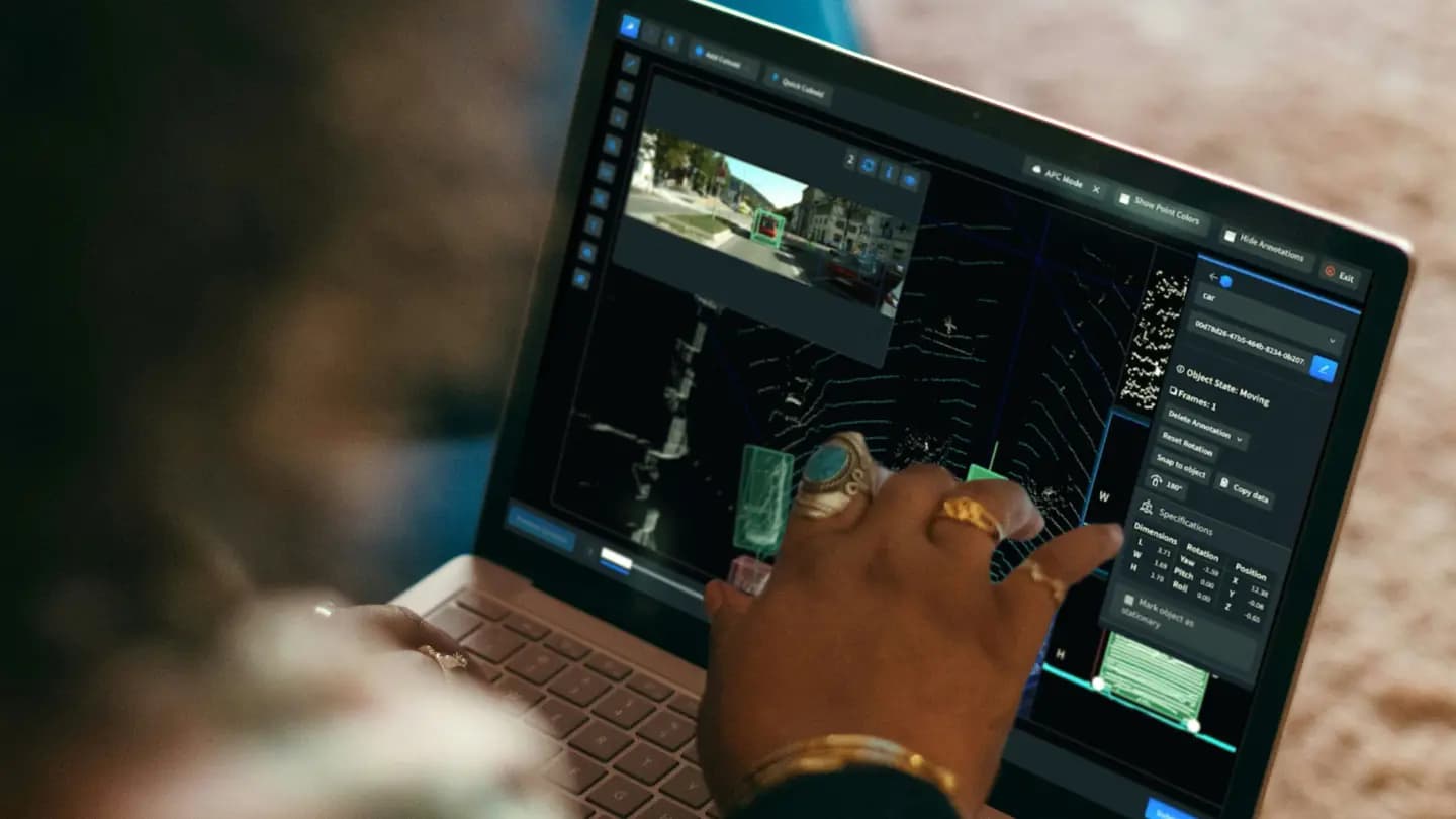
3D sensor fusion combines data from multiple sources, such as lidar sensors and camera devices, to provide varied and accurate object data. Point clouds (a set of data points in space that represent a 3D object) provide detailed shapes of identified 3D objects, ranging from simple classes like buildings, to complex, such as distributed pixels of the sky or vegetation.
Types of sensor fusion data labeling
The following are some of the types of sensor fusion data labeling used commonly today.
- 3D object tracking: All objects of interest are assigned unique object identifications to provide accurate object detection and tracking across frames in 3D point cloud scenarios.
- 2D-3D linking: This method provides accurate object detection and tracking across frames in 2D and 3D scenarios. All objects of interest are assigned unique tracking identifications and are linked in both scenes.
- Bird’s-eye-view labeling: Often leveraged for autonomous driving use cases, labeled areas include no-risk, drivable areas and high-risk areas such as sidewalks.
- Point cloud semantic segmentation: This method provides accurate point-wise segmentation of 3D point clouds. Segmented objects include buildings, cars, vegetation, sky, roads and more.
- Object classification: Objects are classified for road scenes for autonomous perception models with multiple attributes.
Applications of 3D sensor fusion
Sensor fusion data has multiple use cases that span industries. The following are some examples of them.
- Autonomous vehicles: 3D sensor fusion is critical for developing self-driving vehicles that can safely navigate their surroundings. The data emulates the sensory inputs a human driver would encounter and react to.
- Robotics: Sensor fusion data aids in the navigation, mapping, localization and collision avoidance in autonomous mobile robots, including inventory management robots used in warehouses, vacuum robots used in homes and more.
- Security: 3D sensor fusion data is used to make perimeter security and intruder detection more accurate .
- Precision agriculture: Sensor fusion data is used to create high-resolution 3D crop maps. This allows farmers to see differences in crop growth, identify areas of water stress and more.